
Below Highway 1 an Evacuation Alert was placed on thirteen properties in May 2018. Rapid erosion has undercut the creek banks and put homes and people in danger. The Evacuation Alert was lifted in October 2018, but the creek remains in flux.
The area in question is north of the Trans-Canada Highway, between the highway and the lake. Sorrento Centre is to the west, and Caen Road to the east. The “Area Monitored” comes from to the 2018 Erosion Report done by Westrek Geotechnical Services Ltd. The photo below was created by the authour of that report.
Area Monitored

Progression Of Damage
About half way down the area monitored you can see how the erosion has been developing. This is a mini-version of what has been happening in the creek for some time now. From May 2017 to May 2018 the creek bed shifted from its channel on the west (Sorrento Centre) side, and created an new channel on the east (residential) side. It widened and deepened in 2018 as the Spring freshet progressed.
The photos below show that in 2017 the vegetation and the toe of the bank are intact. In 2018 a large amount of material has been eroded and the creek is flowing underneath a large cedar tree.
Click to compare the changes.

More Erosion
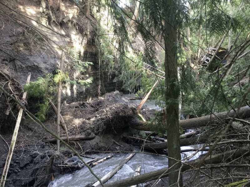
Upstream in the area monitored considerable damage had already been done in 2017. In May 2018 it got worse.
The photos below show that in 2017 (and prior) trees had fallen into the stream bed. In 2018 the channel shifted further toward the residential side.
Click to compare the changes.
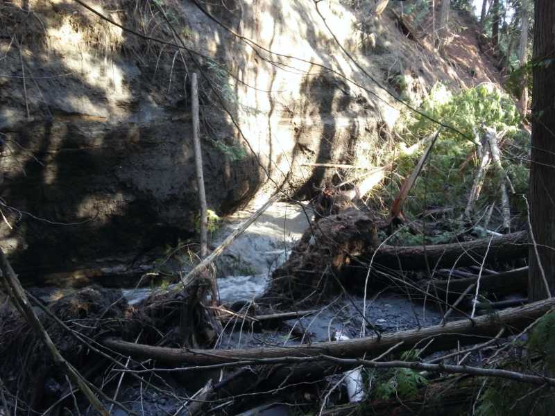
Problems With Falling Trees

As the erosion continues more and more trees fall into the ravine. This creates an empty pocket against the bank where the root ball used to be. Water rushes into the open space and the root forces the channel to cut further into the bank. It holds the new channel in place barricading the water flow from shifting back to the centre. In the 2017 KWL Report it was noted;
… the sediment and large fallen trees continue to redirect flows into unprotected areas of the ravine banks. This process will continue. The fallen trees may be removed to reduce the debris from directing flow to the right bank. It may be possible to move sediment using hand tools from the centre of the channel to the side to direct flow away from the bank.
Unfortunately there was no follow up on the report and events unfolded as predicted.
The 2018 Westrek report stated;
Bank erosion has caused sediment accumulation and tree toppling that has altered the channel, and as a result, the stream has attacked the gully sidewall in a number of locations. As the channel process evolves, further de-stabilization within the currently affected reach is likely to occur.
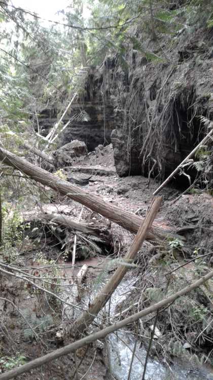
More Problems With Falling Trees
A Danger Tree Report was done by Forsite in June 2018 identifying 64 trees that need to be dealt with. Less than a week later a wind storm blew through Sorrento toppling a large tree that smashed down on a wood working shop.


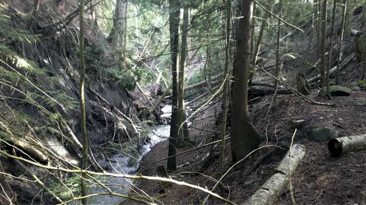
Moving Further Up The Creek – A Meditation Walk?
At one time this creek served as a meditation walk for Sorrento Centre. People walked a trail from Dieppe Road up through the trees beside the stream. It was a nice path that crossed the creek a couple of times on small foot bridges. It wasn’t long, but it was accessible and safe.


Home In Danger
Above this area there’s a home in danger. The homeowner, featured in a Global News report, has been trying to get the attention of the authourities since 2017. She read the 2017 KWL report and hoped there would be action. In 2018 things got worse and others downstream began to feel the effects of the forces in the creek. A wood working shop and pottery studio are now in danger, as are a number of garages and sheds. The threat to property and safety is far from over, and the problem is getting bigger.
 Further Up The Creek at Highway 1
As noted in the post on Water Contamination, the culvert at Highway 1 is causing a lot of damage. The 2018 Westrek Report made note that it is having a long term effect on the creek;
Observations suggest that the culvert on Highway 1 crossing is generating a high discharge velocity at the outfall, and this has resulted in the development of a significant scour pool below the outfall and some undercutting of the highway embankment. It is not clear if this has led to the development of the near-vertical bank adjacent to the 1185 Passchendaele Road property or not, or if this feature has developed subsequent to the 2009 wildfire. A more detailed study would be required to assess this with more certainty.

Help Needed Now As Problems Progress
The upper watershed is not stable. The long term effects of the 2009 wildfire are playing themselves out in a number of areas. Human intervention along the creek, such as undersized culverts and diverted waterways, are causing problems downstream. These problems are effecting property owners who are concerned about their safety, and the safety of their neighbours. While damages occur the Provincial government is turning away from its responsibility. If work does not get done in the ravine before the 2019 freshet there is legitimate concern that more trees will fall, more land will slough, and the foundations of buildings will be undercut to the point of falling into the ravine.